Ready for more detail? Explore degree requirements, course descriptions, and program outcomes for Land Surveying in the College Catalog. You can also find a sample academic plan for each semester of your college journey.
Career Outcomes Rate:
100%
Source 2023-24 Dunwoody Career Services Annual Report
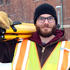
Land Surveying
Already have a bachelor’s degree and looking to explore a new career opportunity? Dunwoody’s Land Surveying Certificate can provide you with an avenue to become a licensed Land Surveyor in the State of Minnesota.
60K
Average Salary: Construction Sciences & Building Technology, Certificate
Source 2023-24 Dunwoody Career Services Annual Report
Dunwoody Land Surveying
Dunwoody’s Land Surveying certificate is created or was intended for those who already have a bachelors degree and are looking to enter the land surveying industry.
This program also provides an accelerated option for those without a bachelor’s degree to become surveying technicians and offers a path for them to become a licensed surveyor with the completion of a bachelor’s degree along with meeting the other requirements for licensure.
Students gain field experience using industry-standard technology and receive instruction from industry experts.
Opportunities to participate in national competitions will help build your resume, and hands-on, outdoor projects and labs get you out of the classroom and into the environment you’ll be working in.
Software you will use include a suite of computer-aided drafting programs (CAD) including Autodesk Civil 3D and Recap. Upon graduation, students who meet the Minnesota Rules Requirements Minnesota Rules 1800.3505 subpart 2 can qualify to sit for the Fundamentals of Surveying exam.
The certificate consists of 22 technical credits, which can be completed in just two semesters.
Credits earned in the Land Surveying certificate directly transfer into Dunwoody’s Surveying & Civil Engineering Technology associate’s degree.
” I had recently received my GIS degree but wasn’t satisfied with where it was taking me, so I enrolled in Dunwoody’s surveying program. The hands-on learning was great, and when I started my summer internship and current job I was able to jump right in. I had the interview for my current position before I had even finished classes. “
Kyle Knutson
Dunwoody Land Surveying Certificate Alum
Explore
Professional Licensure Information for Dunwoody Programs
Class topics include:
- GPS and geodetic surveying
- 2D and 3D drafting
- Boundary control
- Land-use planning
Student Organizations
Opportunities to get involved outside of the classroom include:
- Surveying & Civil Engineering Club
Facilities
Surveying Lab
Uses the Dunwoody campus and its environs as a lab for learning the tools and techniques used in surveying both outdoor and indoor spaces. SURVEYING EQUIPMENT:
- Sokkia Automatic & Digital Levels
- Trimble & Leica Total Stations
- Trimble & Topcon GNSS (GPS) Receivers & Data Collectors
- Phantom 3 & Phantom 4 Drones (used for photogrammetry & RTK surveying)
- Faro Laser Scanner
- Laptop Computers loaded with Industry Software