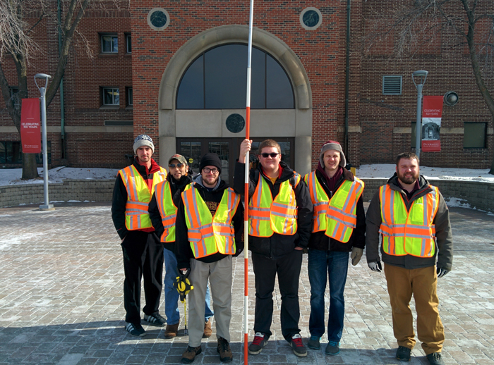
After studying Greek astronomer Eratosthenes’ methods to calculate the circumference of the earth, students in the Geodetic & Controls Surveys class recreated the process using ancient–276 BC–methods and modern technology.
Second-semester students Wyatt Spencer, Jake Blue, Jeremy Brunell, Joe Irey, BJ Klenke and Brandon Davis gathered background information about Eratosthenes from the book “Elementary Surveying: An Introduction to Geomatics (13th Edition).”According to their research: Eratosthenes determined on the summer solstice each year that the sun was directly overhead the city of Syene, Egypt. It was noted that while looking down a particular well, one could observe the sun’s reflection was directly in the middle of the water. He lived in Northern Egypt, in the city of Alexandria, which was 5000 stadia (equal to 500 statute miles) from Syene. In the city of Alexandria on the summer solstice, he then measured the length of the shadow created by a tower in the city of Alexandria. Using simple geometry he calculated the angle between the tower and the shadow, and determined the angle to be approximately 7.2 degrees, which is one-fiftieth of a circle. Eratosthenes then had the distance between Alexandria and Syene measured by averaging the time it took camels to travel the distance between the two cities. He took that measurement and multiplied it by fifty to approximate the circumference of the earth. His result was remarkably accurate, differing from a commonly accepted value (24,901) by less than 100 miles.
Since the sun was not directly over the Dunwoody campus and it wasn’t plausible to drive the 500 miles to carry out the measurements, the class reached out to a forum called surveyconnect.com to ask for a volunteer to assist them in measuring the angle of the sun’s rays. Dan Robinson, of Little Rock, Ark. responded to the students’ request for assistance.
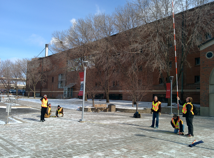
On January 16 at approximately solar noon, the students went outside in front of campus with a 24-foot pole—which they made by connecting six four-foot range poles. They held the pole vertically and used a plumb bob to confirm it was vertical. They then used a 100-foot tape measure to determine the length of the shadow cast by the range pole.
They measured a shadow at 59.9 feet from the base of the pole to the tip of the shadow. At approximately the same time—solar noon in Little Rock, Ark.—Robinson measured the shadow of 39.6 feet from a 25-foot pole.
“Dan’s participation was greatly appreciated,” said Principal Instructor Kelly Ness. “I think it speaks for the support students have from others in the surveying community.”
Using the coordinates Robinson gave them for his location (N 44-35-00 W 93-10-00), the coordinates of Dunwoody College (N44-58-22 W93-17-28) and a program to convert coordinates to geodetic distance (http://www.movable-type.co.uk/scripts/latlong.html) the students determined the distance between the College and Dan’s location to be 706.49 miles. With this information they were able to calculate a circumference of 24,383 miles. The value they calculated is similar to a currently accepted value of the earth’s circumference at the equator of 24,901 miles.
Although they enjoy the modern day GPS (GNSS) technology they’re using in their classes, the students are interested in additional projects using ancient methods of measurement.
“Next we will create a triangulation network similar to the method used from the late 1700s through the 1900s,” said Ness. “Surveying is a profession that will forever be tied to the past.”
For more information about Dunwoody’s Surveying & Civil Engineering Technology program, visit http://dunwoody.edu/construction/surveying-civil-engineering-technology.